
Aerogeophysical Systems
UTIG has developed, maintained, and operated a suite of aerogeophysical instrumentation since the early 1990s with continual improvements since inception. The suite was installed aboard a Dehavilland DHC-6 ("Twin Otter") up to 2005 and aboard a Basler BT-67 (a version of DC-3T -- a Douglas DC-3 refitted with turboprop engines) since 2008. Contact Don Blankenship for more information. Find available data.
The current instruments are:
High Capability Radar Sounder (HiCARS), a VHF ice-penetrating radar which operates in frequency-chirped mode from 52.5 to 67.5 MHz. HiCARS allows for phase coherent recording of radar returns for advanced processing. For antennas the system uses twin flat dipoles, one mounted under each aircraft wing providing approximately 10 dB of antenna gain. The peak instantaneous output power is 8kW. HiCARS has been operated extensively in Antarctica and has regularly sounded deep and highly crevassed ice.
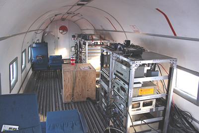
Photo by Jack Holt.
A Multibeam, Scanning Photon Counting Lidar images the surface below the aircraft with one hundred laser beamlets which are mechanically scanned in a swath either side of the flight path. A one hundred channel photon counting receiver captures return photons and records time of flight and time tag data allowing a three dimensional reconstruction of the surface flown over. The system can make 2.2 million measurements per second. At the typical survey elevation of 800 meters, the swath width is about 400 meters.
A Cesium Vapor Magnetometer for scalar geomagnetic field strength measurements is mounted in a tail boom on the DC-3T and in a deployable towed "bird" on the DHC-6.
Dual-frequency, carrier-phase Global Navigation Satellite Systems (GNSS). GPS and (Russian) GLONASS are recorded for satisfying the extremely precise aircraft positioning requirements to enable the lidar and gravimeter operations. The DC-3T in survey configuration carries four GPS antennas distributed across the aircraft which provide data redundancy and a source of aircraft attitude and heading through differential processing of the recorded GNSS data.
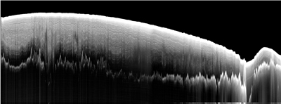
Image provided by Duncan Young.
A fixed, nadir pointing Laser Altimeter is the predecessor to the Scanning Lidar and provides comparison data for the Lidar.
Two GPS-aided Inertial Measurement Units are included in the suite, one standalone and one integrated with the Scanning Lidar.
A Three-Axis Fluxgate Magnetometer is included to provide vector magnetic field data for use in operation of the Cs-Vapor Magnetometer.
System Control, Data Acquisition, and Real-time QC and Monitoring functions are done with a computer control and interface to the suite. The instrument suite generates about 200 Gbyte of data during a seven hour survey flight.


