Combining Extended Continental Shelf Exploration and Scientific Interests:
The Case of the Demarara Plateau Offshore French Guiana
By:
Walter Roest
Ifremer
Join us for coffee beginning at 10:00 a.m.
Click for a Live Broadcast.

Abstract
The UN Convention on the Law of the Sea allows coastal states to obtain sovereign rights over the continental shelf beyond 200 nautical miles, throughout the natural prolongation of its land territory to the outer edge of the continental margin. The Commission on the Limits of the Continental Shelf established under the Convention examines submissions made by coastal States.
The French national program established to make those submissions, EXTRAPLAC, started in 2002 with funding from the French Government. The program is led by Ifremer, with as principle partners the SHOM (Hydrographic and Oceanographic Service of the Navy), IPEV (French Polar Institute) and IFP Energies Nouvelles. Seven submissions, of which 3 are joint with neighboring states, have been made thus far, concerning areas off metropolitan France and its overseas territories.
In total, over 360 days of ship time was needed to explore these vast and dispersed areas, in the Atlantic, Pacific and Indian Oceans. The data collected include multibeam bathymetry, seismic reflection and some rock sampling. In this presentation we will describe how the EXTRAPLAC cruise offshore French Guiana (GUYAPLAC, R/V L'Atalante, 2003) led to new scientific results for this transform type margin, in particular in the area of the Demerara Plateau. Results include the discovery of gigantic submarine land slides in the subsurface, and associated fluid escape features on the seafloor.
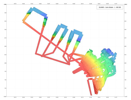
A scientific collaboration between the EXTRAPLAC team and academia led to a follow-up cruise proposal to further explore this unique continental margin: The IGUANES cruise, led by Lies Loncke of the University of Perpignan, took place in April/May 2013 on the same research vessel, using a higher resolution multibeam echosounder, high resolution seismic reflection and sediment cores.
In particular, we were able to confirm and better map significant submarine landslide scarps, aligned pockmark fields and sediment waves that are likely associated with strong bottom currents and/or the submarine landslides. We will also briefly describe some of the highlight results of other EXTRAPLAC related cruises to show how the EXTRAPLAC program has resulted in new knowledge in remote frontier areas that had very little modern data coverage.


