
Back to PLATES' homepage.
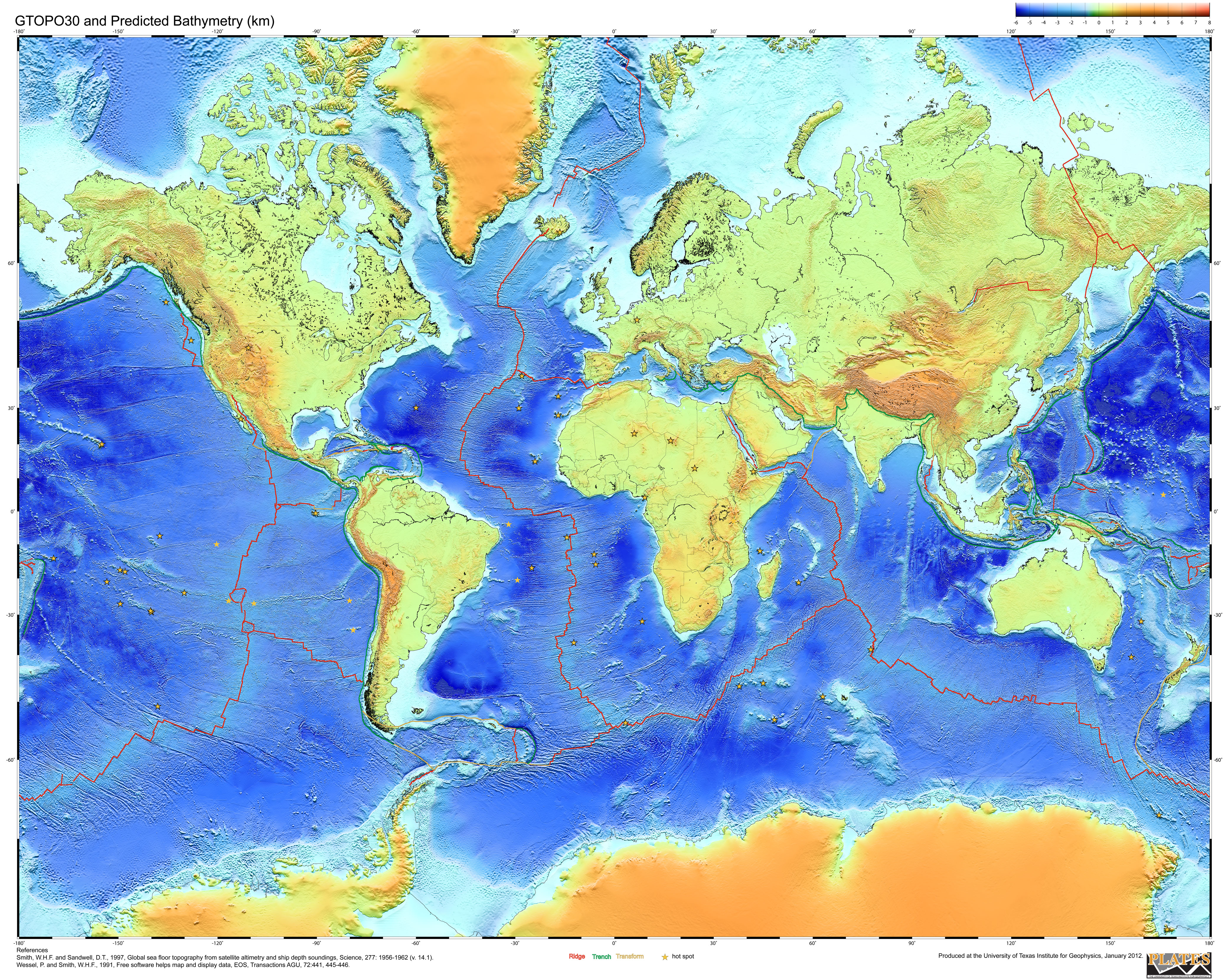
Plate boundaries are from the PLATES Project digital data compilation.
Topography is from Smith and Sandwell 1997 (Science, vol. 277, pp. 1956-1962) plotted using GMT mapping software (Wessel and Smith, 1991, EOS, Transactions AGU, vol. 72, pp. 441, 445-444).
Map produced at the University of Texas Institute for Geophysics, 2012.


