
PPT
- Pensacola-Pole Transect |
|
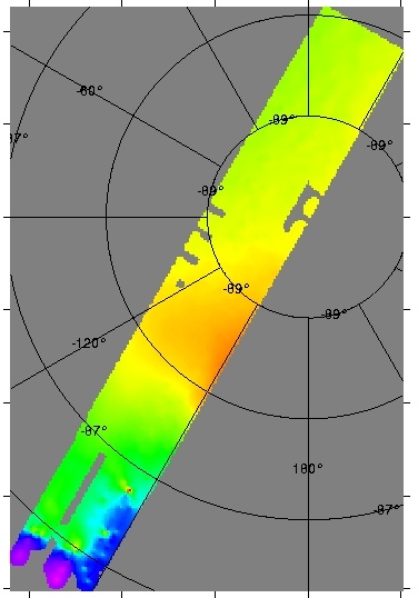
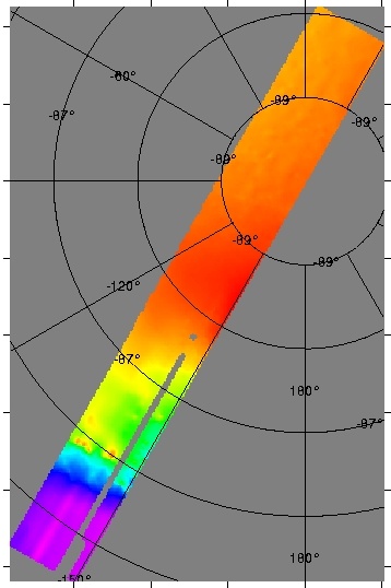
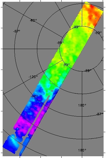
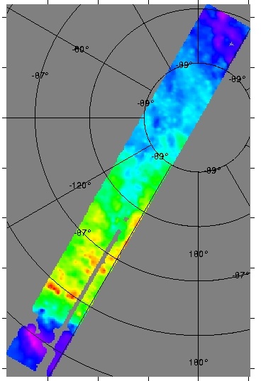
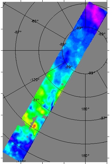
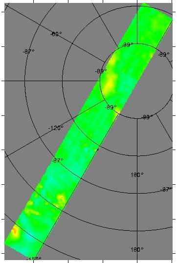
The PPT survey extended from the Ross Ice Shelf, southward over the TAM along 150W between the Scott and Reedy Glaciers, and through the South Pole. Approximately 15,000 line km were flown. North-south oriented transects were flown 10 km apart and west-east tie lines were flown with a 30 km line spacing. Fifteen km long transect 'run-ins' and 'run-outs' were added to each line, thus ensuring data collection to survey boundaries. Laser altimetry, ice-penetrating radar, gravity and magnetic field intensity data were collected. This work was funded by NSF-OPP 9319379 with the project title: Collaborative Research: Contrasting Architecture and Dynamics of the Transantarctic Mountains (Pensacola-Pole Transect). Principal Investigators were D.D. Blankenship, University of Texas Institute for Geophysics, and R.E. Bell and W.R. Buck, Lamont-Doherty Earth Observatory. |
|
Gridded data
|
View
the Summary
of Proposed Field Work