
Quantifying the kinematics of crustal deformation:
Examples from northwestern Basin & Range Province
and northern California, USA, and Maracaibo block, Colombia-Venezuela
By:
Dr. Caroline (Carrie) S. Whitehill
Institute for Geophysics,
University of Texas at Austin
When: |
Friday, February 12, 2010, 10:30 a.m. to 11:30 a.m. |
Where: |
Seminar Conference Room, 10100 Burnet Road, Bldg 196-ROC, Austin, Texas 78758 |
Host: |
Sean Gulick, UTIG |
Abstract
One of the challenges of modeling the evolution of crustal deformation is our lack of understanding of the spatial and temporal patterns that span geologic (106-109) through geodetic (101) time scales. These results and examples from the northwestern Basin and Range Province and ongoing research along the margins and interior of northern California and in northern South America present some new perspectives on unresolved problems in each of these areas.
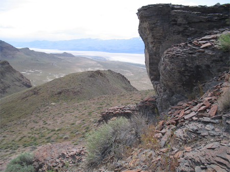
BASIN AND RANGE
The Shawave-Nightingale horst block (SNHB) is a N-S trending synclinal accommodation structure formed at the transition between opposing tilt domains along the northwestern margin of the northern Basin and Range Province (NBR) and located centrally within the Black Rock-Carson Sink region. Detailed mapping of volcanic strata across the horst block and 40Ar/39Ar dating of 19 basalt samples document three episodes of volcanism spanning ca. 18 Ma to 11 Ma, coincident
with (1) the onset of Miocene extension in the central and eastern northern Basin and Range Province (~18-15 Ma), (2) the onset of extension within the SNHB (~14 - 12 Ma), and (3) at ca. 11.5 Ma during the peak of slip on the GSVF. Conservative estimates suggest a minimum of 4 km normal slip on the prominent, N-S trending range-bounding Granite Springs Valley fault. Stratal tilt-fanning and conglomerate units mapped within the hanging wall sequence document a minimum of three extensional pulses; the first began by 11.5 Ma and was followed by two smaller events that initiated by 9 Ma and predate passage of the Mendocino triple junction at this latitude.
Apatite fission track and (U-Th)/He thermochronology results suggest that extension began by 14.5 Ma, was sustained through ca. 8.6 Ma, and involved > 8 km of slip on the Granite Springs Valley fault during this time period. The total amount of slip estimated since inception of faulting is 10.5 km. Inverse modeling of AFT and AHe data for four samples shows a rapid pulse of extension that initiated between ca. 15-12 Ma. The onset of normal fault slip on the GSVF documents a transitional phase of extension that post-dates middle Miocene extension (19-15 Ma) that occurred across much of the northern Basin and Range and pre-dates late Miocene (12-10 Ma) fault initiation along the northwestern margin of the Basin and Range
NORTHERN CALIFORNIA
The 2007 GeoEarthscope LiDAR data acquired in northern California presents an extraordinary opportunity to advance our understanding of the major active faults of the region. These data provide an unobstructed view of active faults that make up the plate boundary, spanning the transition from Cascadia subduction approximately 150 km south of the Oregon-California border to the mature San Andreas system south of the San Francisco Bay region. New mapping of the active fault traces of the Peninsula, Loma Prieta and Creeping sections of the San Andreas fault, San Gregorio-Seal Cove faults, South Hayward and Northern Ma'acama reveals field localities for potential paleoseismology investigation, identification of strain markers such as offset and beheaded streams, sag ponds, and active landslides. The use of LiDAR data provides an unprecedented means of identifying features necessary for better constraining a more complete slip history seismic and landslide hazard potential. By these means, we strive to comprehend a more complete slip history distributed along and inland from the primary San Andreas plate boundary fault system.
MARACAIBO BLOCK OF COLOMBIA AND VENEZUELA
Ongoing research with the CBTH group at UTIG includes subsurface mapping of the Santa Marta-Bucaramanga fault system, tectonostratigraphic and structural interpretations of the Cesar Rancheria basin and 2D structural reconstructions along three transects that span the Maracaibo block. The primary objectives are to quantify the timing and amount of shortening and the basin geometries to resolve ambiguities in current kinematic models and to serve as an exploration tool.


