
Beyond Geodesy:
GPS Applications to Seismology and Climate Studies
By:
Dr. Andria Bilich
National Geodetic Survey, Geosciences Research Division
When: Friday, Dec. 04, 2009 10:30 a.m. to 11:30 a.m.
Where: Seminar Room (Room 1.603), 10100 Burnet Road, Bldg 196-ROC, Austin, Texas 78758
Host: Charles Jackson, UTIG
Abstract
The Global Positioning System (GPS) is a constellation of satellites that, depending upon the type of receiver and/or software, enables a user to position themselves to within a few meters or even centimeters. For years, the geodetic GPS community has consistently achieved mm-level precision for geophysical studies such as plate motion rate determination, volcano monitoring, postseismic relaxation, local tectonics, and glacial motion. This level of precision and accuracy is possible by using a combination of equipment, software, and products, eg. precise GPS satellite orbit information, dual-frequency GPS receivers, advanced software packages for post-processing the GPS observations, and multipath-mitigating antennas, to name a few.
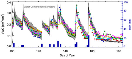
Recent work demonstrates that this same equipment and the associated existing geodetic GPS installations can be leveraged for non-traditional geophysical studies, potentially complementing existing techniques. In this seminar I discuss just two of these new GPS applications, high-rate GPS to observe earthquakes and reflected GPS signals for soil moisture monitoring. I outline how these applications are possible, their relative advantages and limitations over more conventional methods and tools, and provide a few examples. For the case of earthquake observation, the GPS station must be sufficiently close to a large event to observe motions above the GPS noise floor, and operating at a high sample rate to avoid aliasing. When these conditions are satisfied, GPS is capable of estimating displacements without integration or clipping. For the case of soil moisture studies, GPS signals reflect off of the ground and changes in signal strength are correlated with soil moisture content. This application works for GPS stations in more rural locations and GPS receivers reporting accurate signal-to-noise ratios (SNR). When these conditions are satisfied, GPS is capable of observing changes in soil moisture content at scales appropriate for calibrating soil moisture satellite missions.


