
Trajectory Forecasts Based on Numerical Ocean Circulation Models and Satellite Observations:
A Rapid Response to Deepwater Horizon Oil Spill
By:
Yonggang Liu
University of South Florida
| When: | Friday, September 24, 2010, 10:30 a.m. to 11:30 a.m. Join us for coffee beginning at 10:00 a.m. |
| Where: | Seminar Conference Room, 10100 Burnet Road, Bldg 196-ROC, Austin, Texas 78758 |
| Host: | Jack Holt, UTIG |
Abstract
The Deepwater Horizon oil spill presented an unprecedented threat to
the Gulf of Mexico marine resources. Needed for mitigation efforts
and ship survey guidance was a system for tracking the oil, both at
the surface and at depth. A nowcast/forecast system was implemented
immediately upon spill onset, by marshaling numerical model and
satellite remote sensing resources available from existing coastal
ocean observing activities. Surface oil locations inferred from
satellite imagery were used to initialize the positions of the virtual
particles in an ensemble of trajectory models, and the particles were
tracked using forecast surface currents, with new particles added to
simulate the continual release of oil from the well. Multiple models
were used for an ensemble forecast. Three dimensional subsurface
tracking was also performed from the well site location at several
different depths. This activity provides an example of how an
Integrated Ocean Observing System (IOOS) as a partnership between the
academics, the agencies, and the private sector can be of great
benefit to the nation.
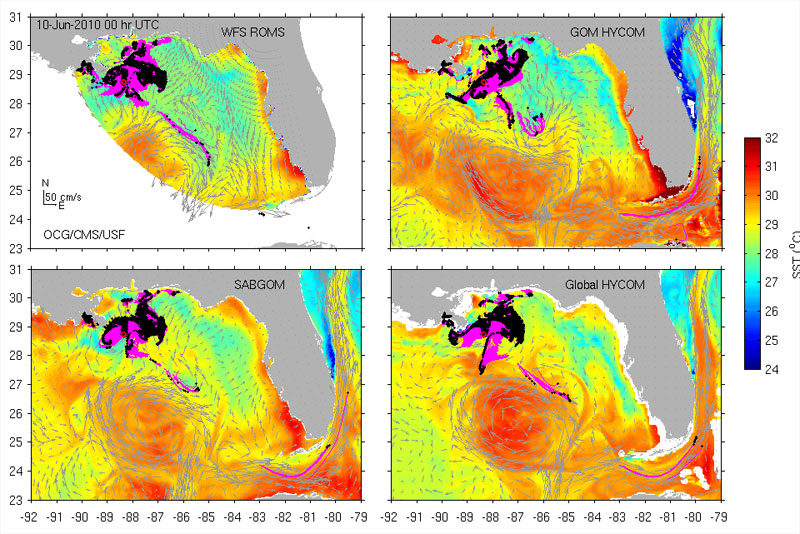
The above figure shows the "Surface Trajectory Multiple Model Ensemble Forecast." Click on it for a larger image.


