|
Thorsten Becker
The University of Texas at Austin Visualizations |
|
[news] [research] [teaching] [team] [publications] [CV] [contact]
downloads:
[SKS compilation] [APM model] [LPO model]
[lecture notes] [papers]
Most 2D plots are made with GMT, and 3D rendering done with Paraview. For information on how to make such maps and use GMT and iGMT, see my computing and Earth science mapping teaching material and the Unified Geodynamics Earth Science Computing Environment (UGESCE). Also see my GMT to VTK conversion tools.
Thermal convection animations
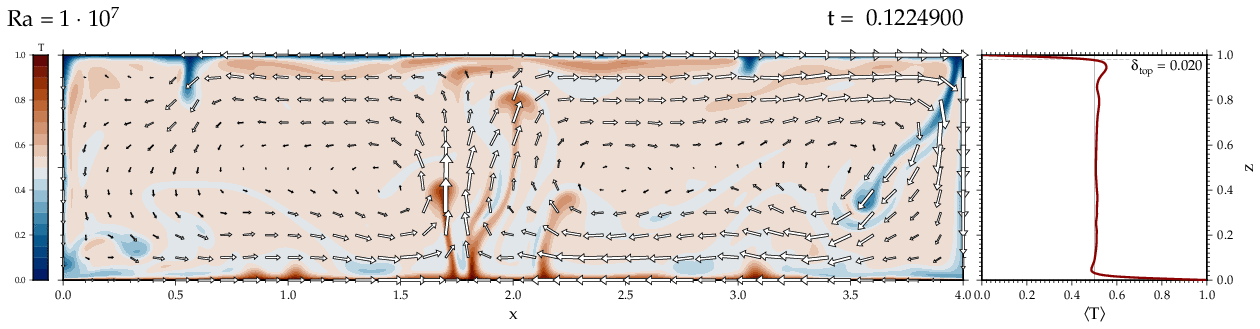
A number of different Rayleigh number and parameter variation cases can be found on the thermal convection animations page.Reconstructed seafloor age and continental drift
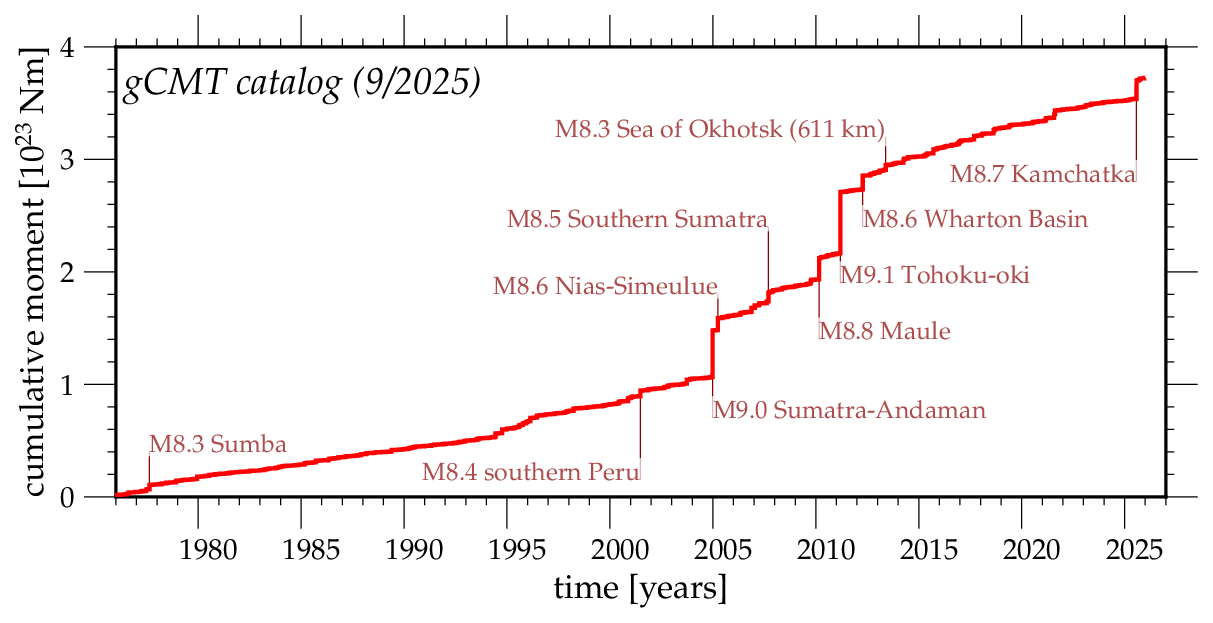
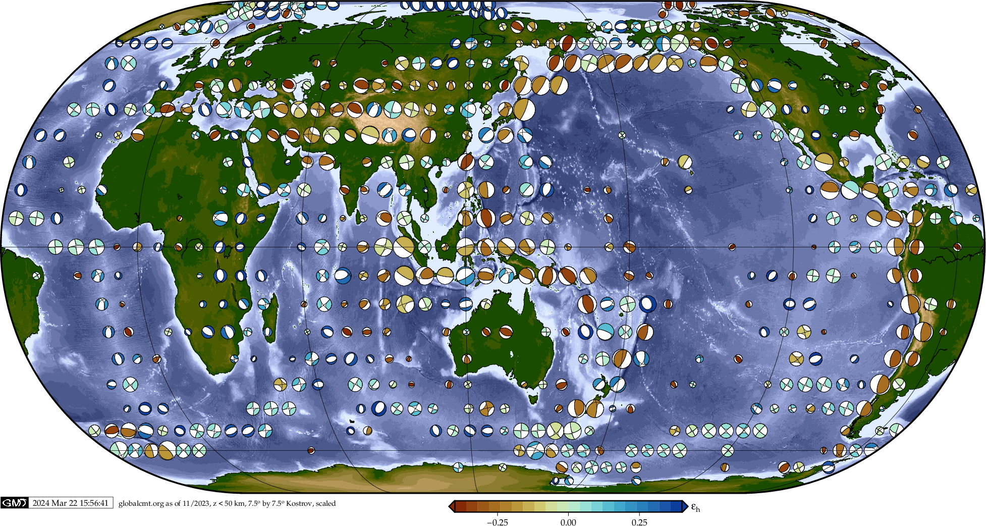
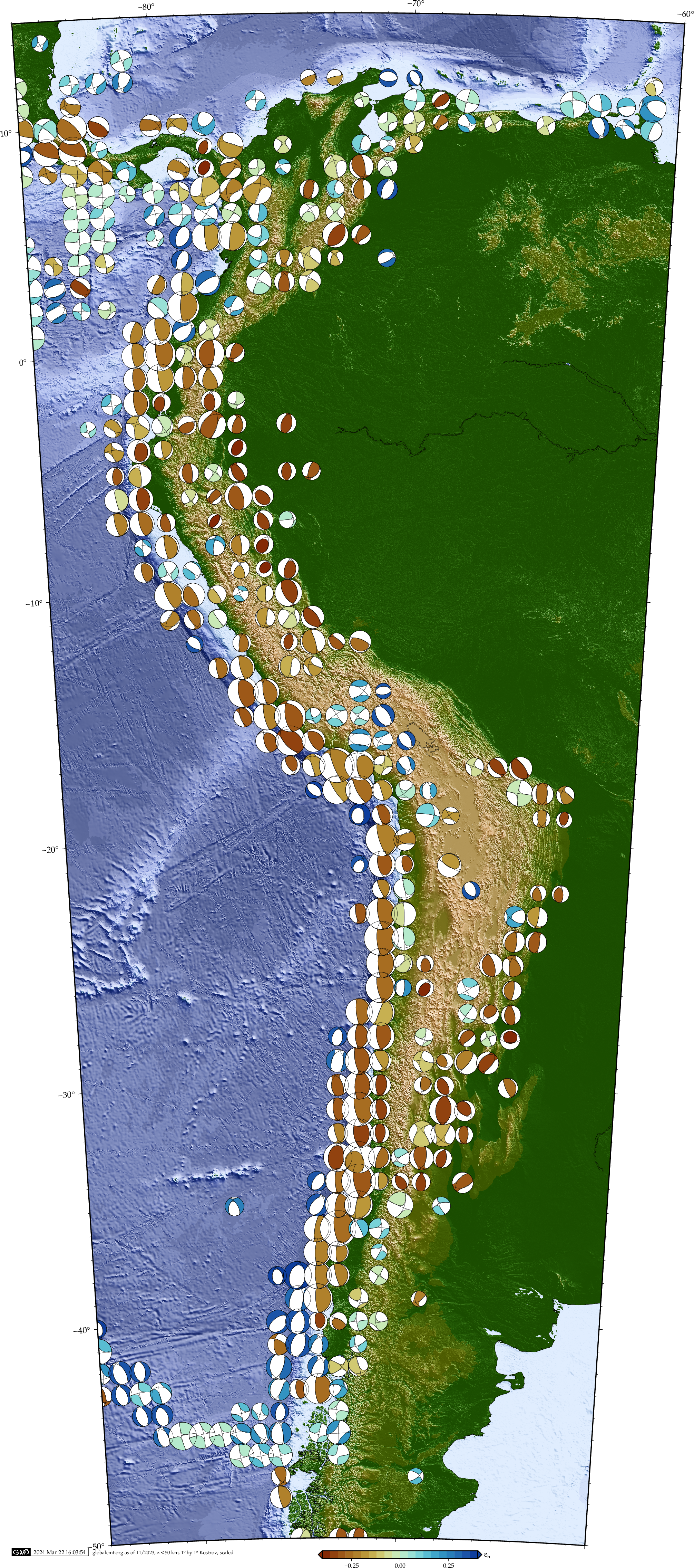
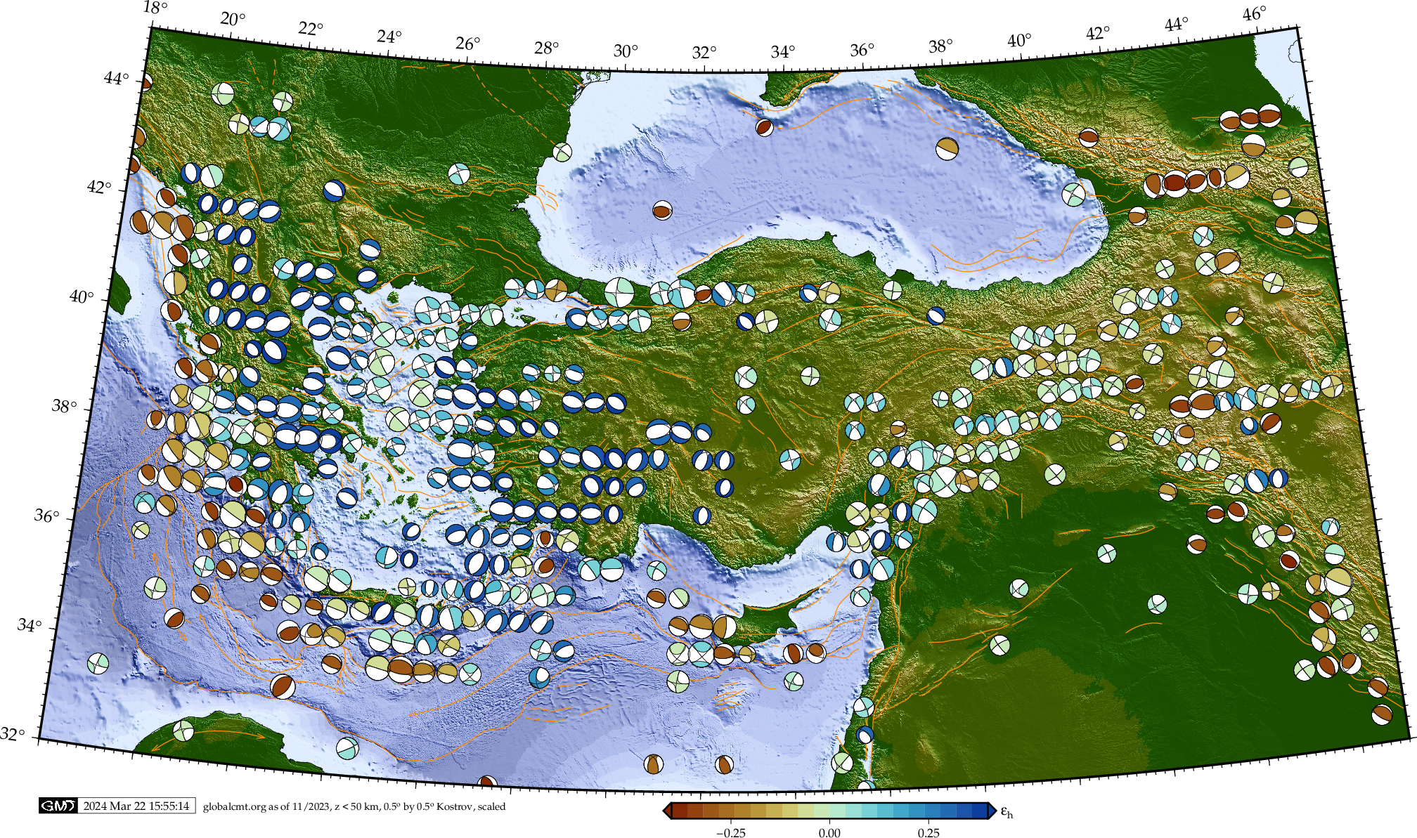
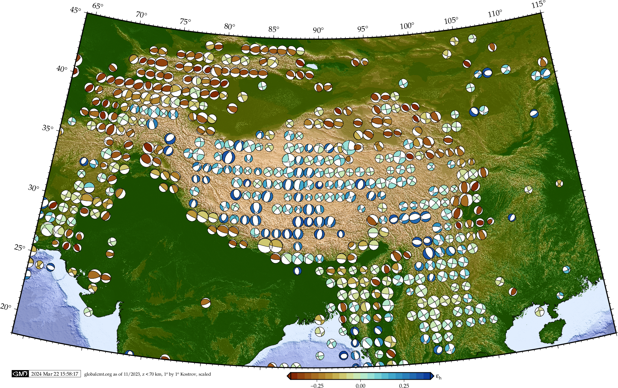
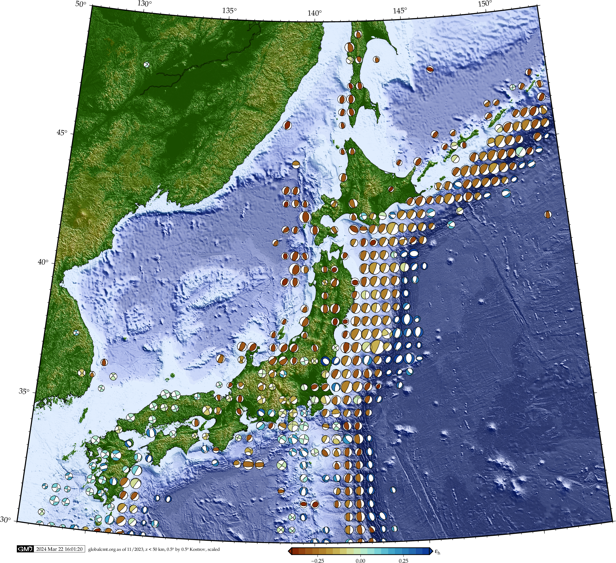
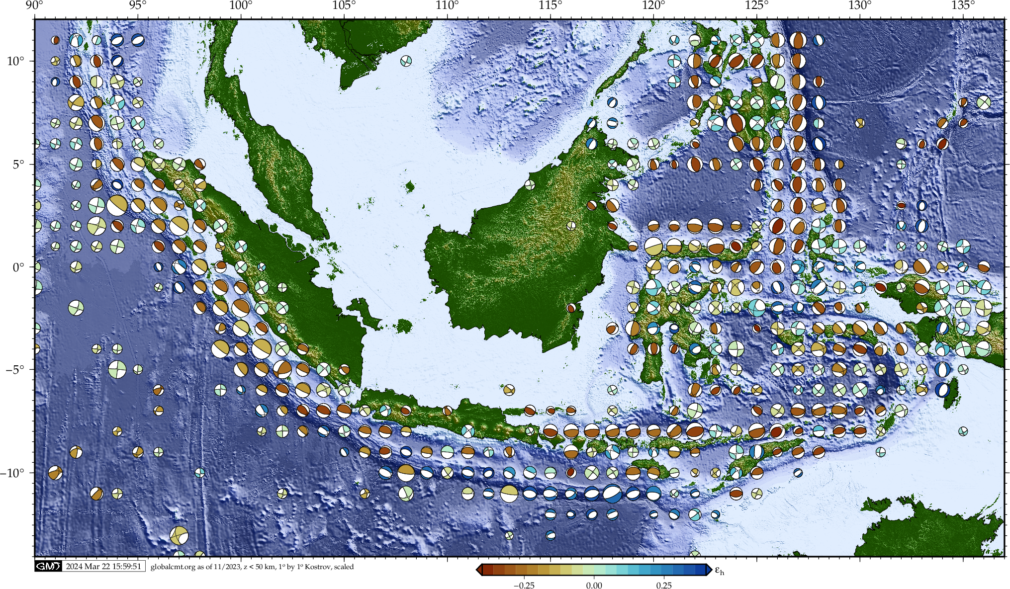
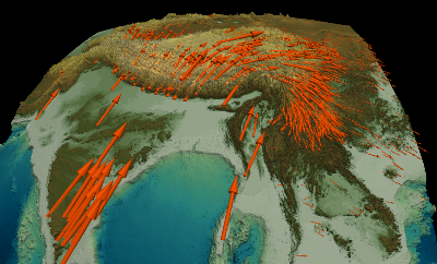
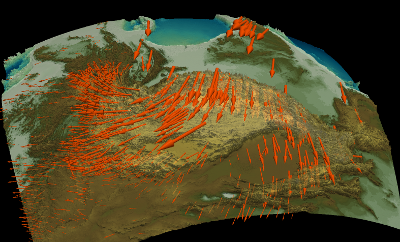
Global and regional lithospheric deformation styles from moment tensors
(Click on thumbnails below for larger PDF maps.)
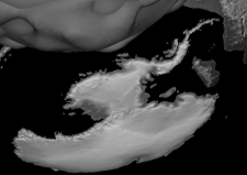
Mantle convection cells visualized

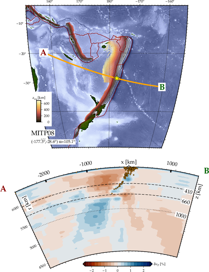
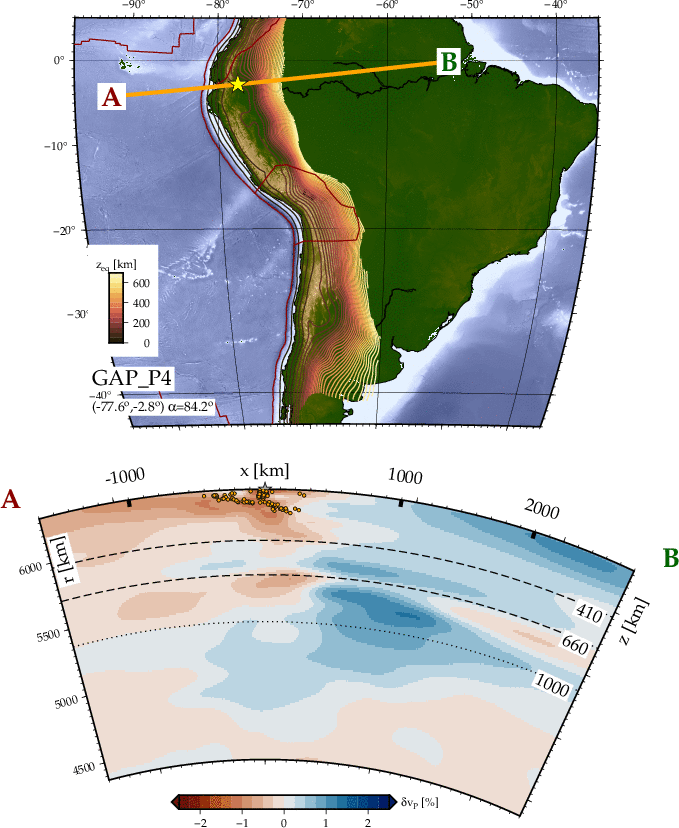
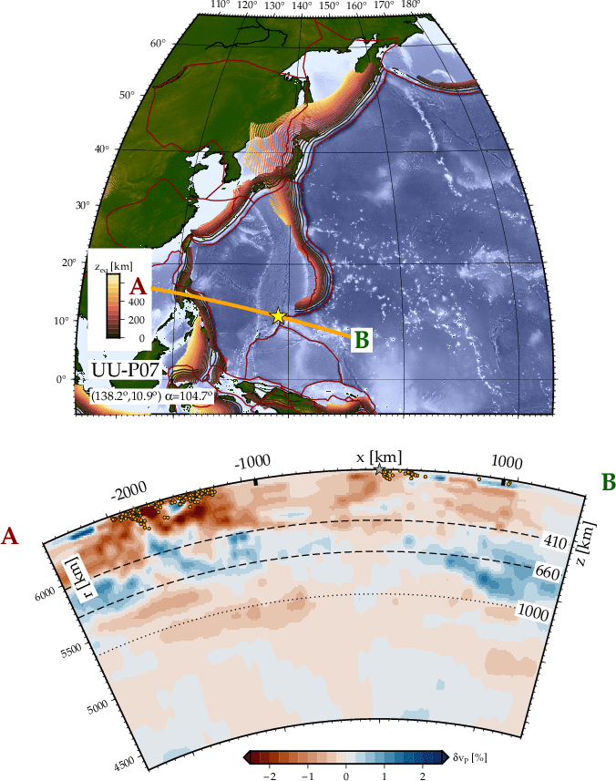
Tomography slab profile surfing
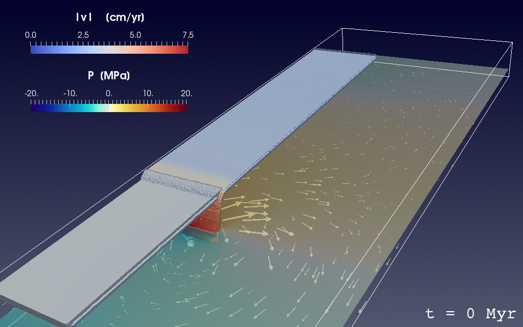
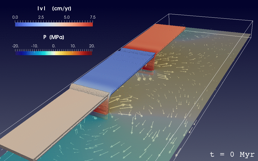
Double slab dynamics movies by Adam Holt
Supplementary material from- Holt, A. F., Royden, L. H., and Becker, T. W.: The dynamics of double slab subduction. Geophys. J. Int., 209, 250-265, 2017. (PDF)
- reference, single slab case
- Outward
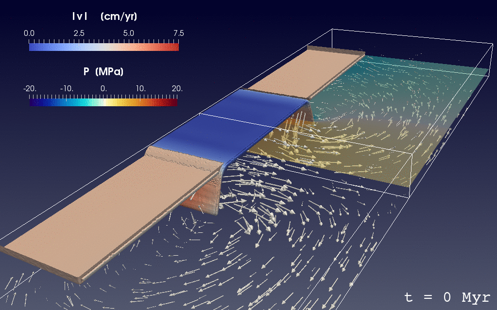
- Inward
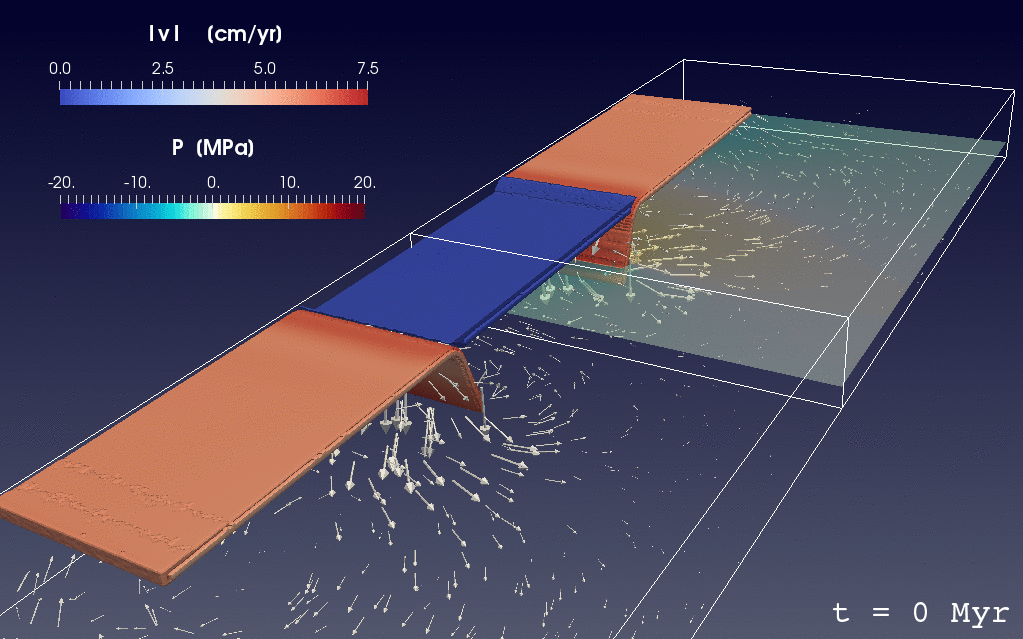
- In sync (cf. Jagoutz et al., 2015)
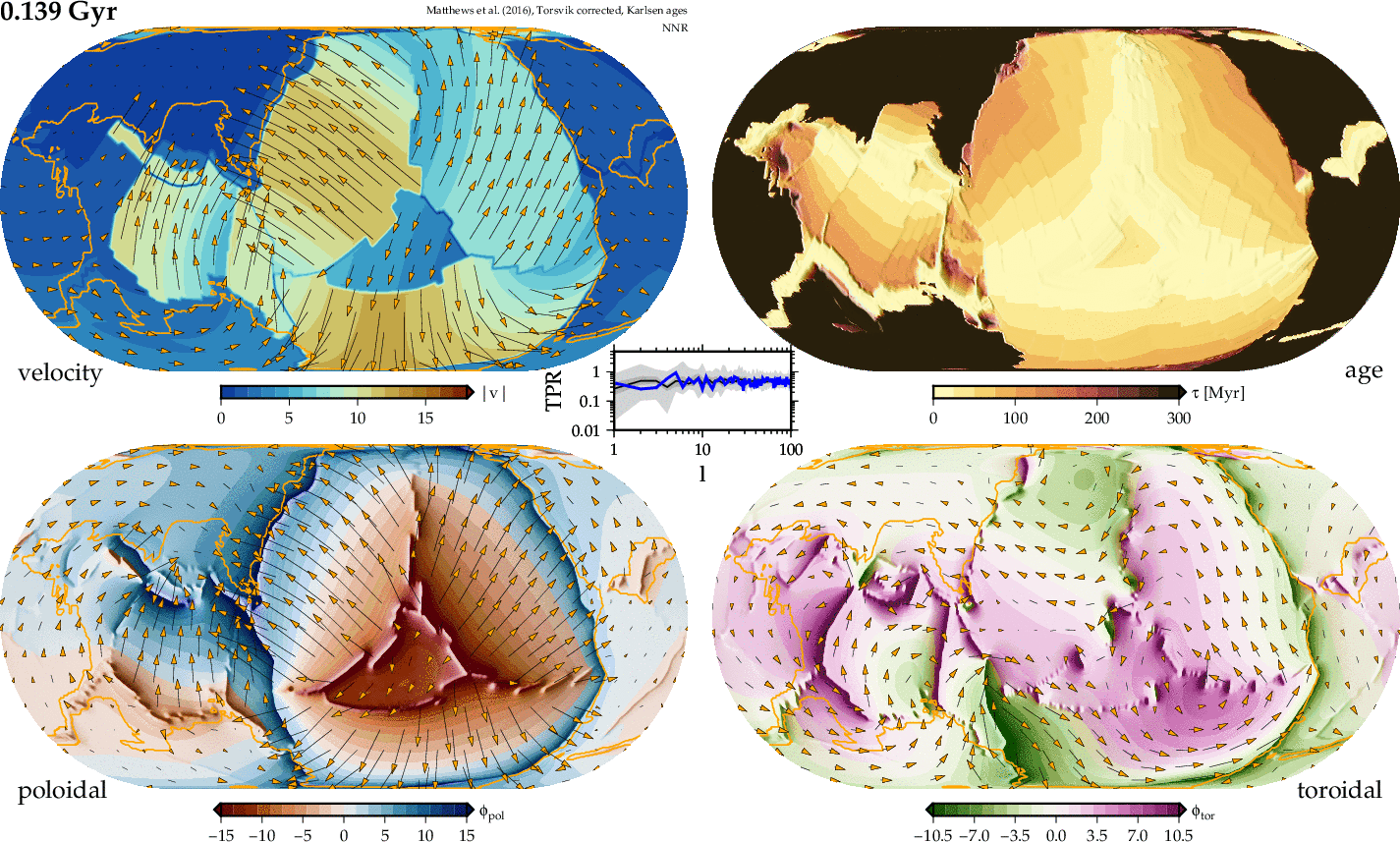
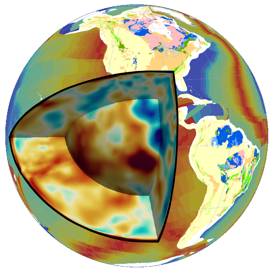
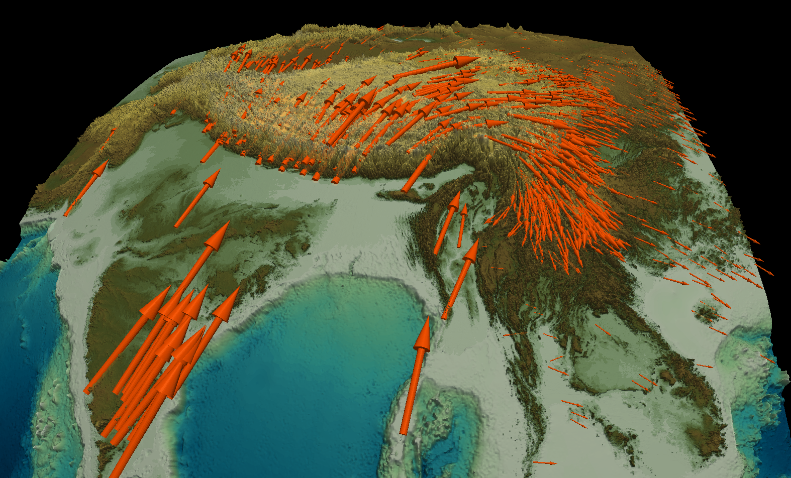
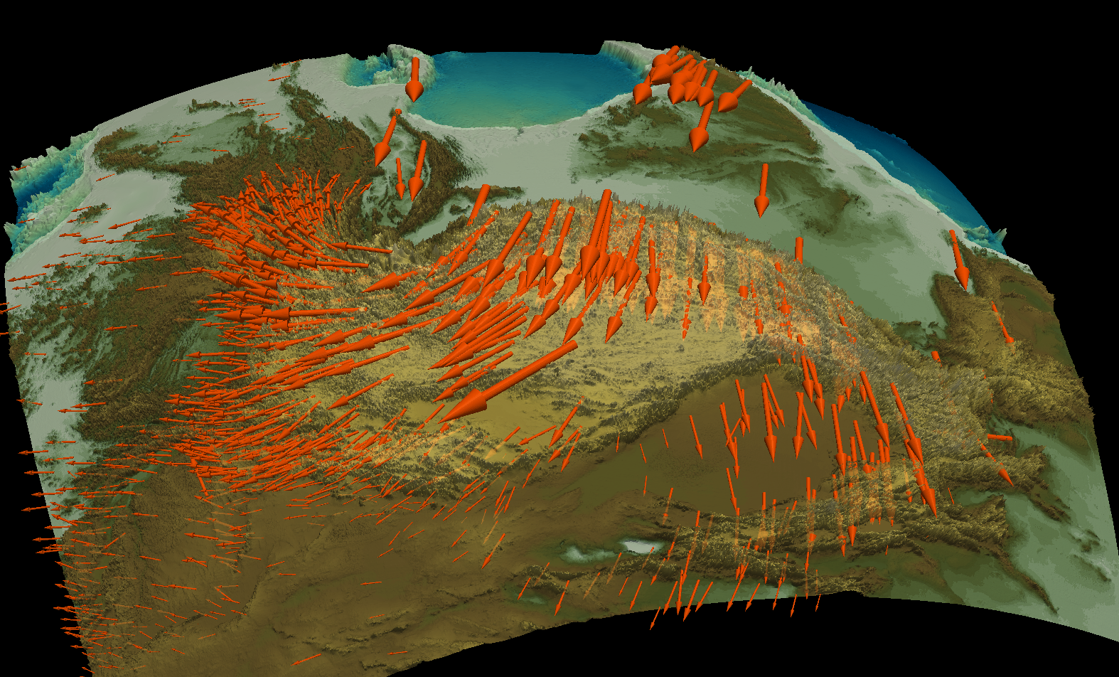
Earth's internal dynamics and surface geology
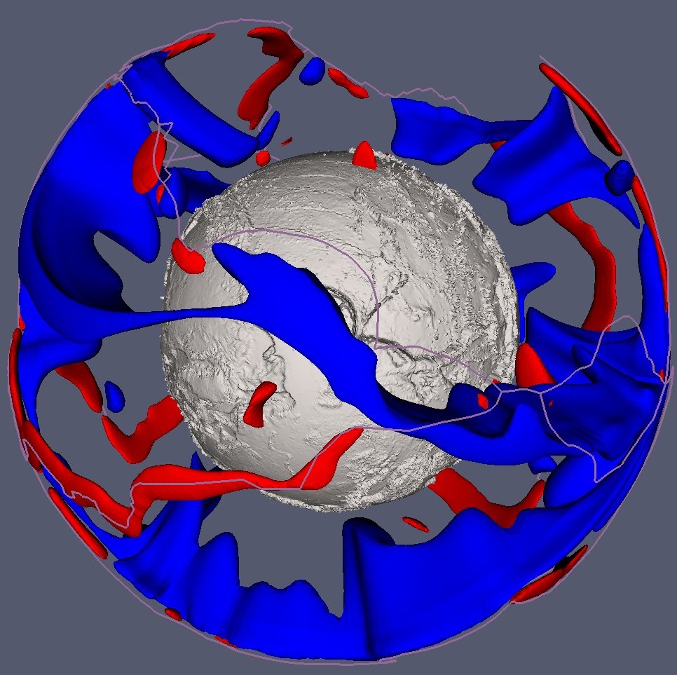
Geoid anomalies
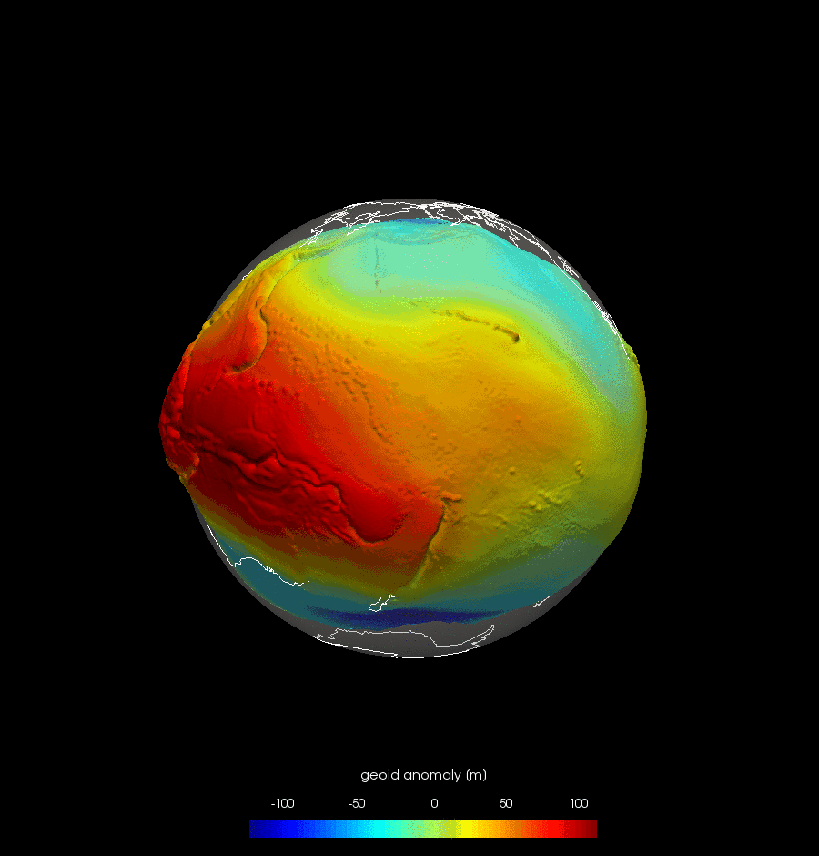
EGM360 geoid anomaly corrected for the shape of an hydrostatic, layered Earth (Nakiboglu). Click here for an equatorial movie of geoid anomalies, and a polar path movie of geoid anomalies.
Mantle convection and plate tectonics

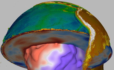
Thermal (mantle) convection models
Snapshots from 3-D, spherical, thermal convection (computed using Citcom by Zhong et al., 2000). Plots show hot (red) and cold (blue) temperature anomaly isosurfaces. Also see our 2-D convection animations.bottom heated internally heated 
Tibetan collision
Global tectonic maps
See the global tectonic maps web page for different projections and datasets.Southern California time-lapse seismicity animation

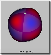
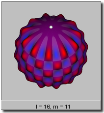
Spherical harmonics visualizations
Hardebeck & Shearer (2004) HASH focal mechanism map for southern California (8MB PDF)
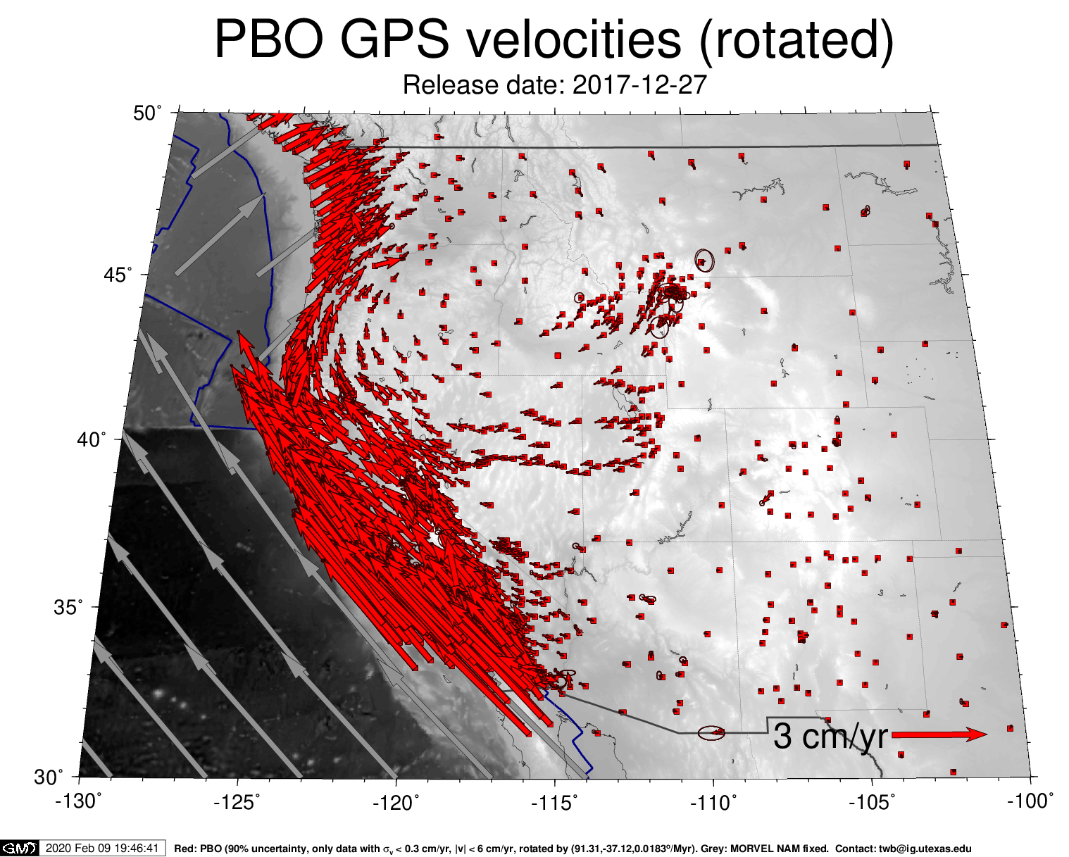
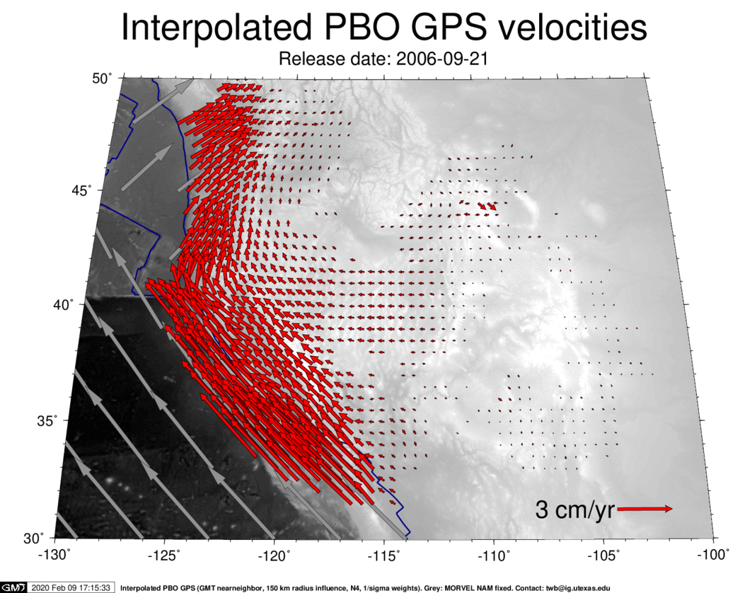
Most recent PBO GPS velocity solution
The UNAVCO consortium ran the Plate Boundary Observatory (PBO) component of the NSF Earthscope program. The map below shows the most recent GPS solutions from PBO for western North America, using the given stable North America reference frame, and then correcting all solutions such that the region from -107/-100/30/49 is stable (i.e. an approximate mid U.S. reference frame).
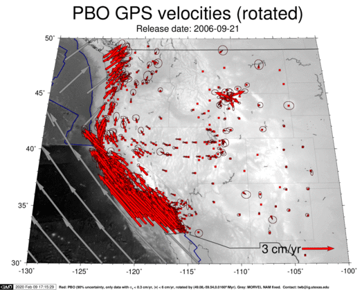
For the most recent plot, click here: [PNG] [PDF]. To track how stations come online and solution quality improves, you might also want to check out the [PBO GPS data movie], the [interpolated PBO GPS data movie], or the [PBO GPS Plot Archive].


[news] [research] [teaching] [team] [publications] [CV] [contact]
downloads:
[SKS compilation] [APM model] [LPO model]
[lecture notes] [papers]